GIS & Remote Sensing
Mapping Nature, Monitoring Change, Making Impact
Explore Ecologia's expert services in GIS and remote sensing for enhanced environmental insights and solutions.
Your Trusted GIS Partner
Ecologia offers specialized GIS and Remote Sensing services, delivering customized solutions that support strategic planning, ecological research, and conservation action.
At Ecologia, we harness the power of Geographic Information Systems (GIS) and Remote Sensing (RS) to help conservationists, researchers, and organizations make data-driven decisions grounded in space and time. From habitat mapping to land-use change detection, our GIS and RS services provide a dynamic and precise lens to visualize, analyze, and interpret ecological patterns across landscapes — supporting efforts toward a more sustainable and resilient future.
150+
Proven Results
🌍 What We Offer
Provide a general summary of the services you provide, highlighting key features and benefits for potential clients.
🗺️ Ecological and Habitat Mapping
We create high-resolution maps of critical habitats, land cover types, and species distributions — essential for site prioritization, biodiversity assessments, and protected area planning.
🛰️ Remote Sensing-Based Monitoring
Using satellite imagery and drone data, we monitor environmental changes over time — including deforestation, wetland degradation, and urban encroachment — helping clients assess and respond to threats effectively.
📊 Spatial Analysis & Modeling
We use GIS to analyze spatial patterns such as species-habitat relationships, connectivity between habitats, and human-wildlife conflict zones. These insights support effective conservation planning and mitigation strategies.
📅 Change Detection & Temporal Analysis
Track how landscapes change over months, years, or decades. Our RS-based time series analyses help evaluate the impact of interventions and natural pressures on ecosystems.
📍 Survey Design & Data Collection Tools
We help teams build custom mobile data collection apps (e.g., using ODK, Epicollect, KoboToolbox) linked to GIS dashboards, enabling real-time field data capture with location tagging.
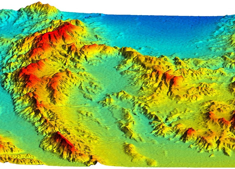
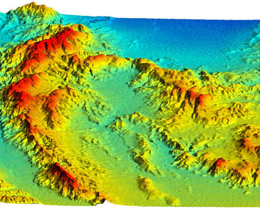
📡 Drone-Based Mapping & 3D Modeling
Ecologia also offers drone-based surveys for ultra-high resolution habitat mapping, species monitoring, and elevation modeling — especially useful in wetlands, forest patches, and rugged terrain.


Who Is This For?
Researchers & Ecologists needing habitat maps and spatial analyses for projects
Government & NGOs managing conservation areas and evaluating landscape change
Students learning to use GIS tools for ecological research
Wildlife Rescuers & Field Teams needing rapid spatial assessments
Policy Makers seeking visual data for informed decisions


Why Choose Ecologia?
Expertise in conservation GIS tailored to your ecological project needs and capacity building.


🌐 Expertise in Conservation GIS
We specialize in ecological applications, not just general mapping. Specializing in ecological applications beyond general mapping for impactful conservation efforts.
🧩 Customized Solutions
From map design to full-scale spatial models — tailored to your needs.
🎓 Capacity Building
We don’t just provide services; we also train you to use the tools through our GIS learning modules and mentorship. Empowering you with tools and mentorship for effective GIS application in conservation.
Examples of GIS Applications at Ecologia
Mapping suitable habitats for endangered species to inform conservation priorities
Analyzing human-wildlife conflict hotspots to support mitigation planning
Tracking forest loss and fragmentation using time-series satellite imagery
Identifying potential wildlife corridors and barriers in fragmented landscapes
Assessing wetland health through vegetation indices and change detection
Designing spatially optimized biodiversity surveys using elevation and land cover layers


I had an excellent experience! The service was outstanding.
Happy client


Contact Us for GIS Services


📞 Contact us today to discuss your mapping and spatial analysis needs.
Or explore our [GIS Training Courses] to build your own skills.

Ecologia's GIS and remote sensing services transformed our project with accurate data and exceptional support.
John Doe

The team at Ecologia provided invaluable insights through their GIS services, enhancing our understanding of the landscape.
Jane Smith
